0+

Projects Done

0B+

Project Costs

0+

Years Experience

Services

Innovation in Focus

01
Project Management Consultancy

On Time. On Budget. Every Time.

      • Efficient project management is the difference between meeting deadlines — and missing opportunities. With decades of experience, we provide end-to-end PMC services, ensuring projects are delivered with precision, cost-efficiency, and uncompromising quality.
          • Our PMC Expertise Cover:
          • Planning & Scheduling – realistic timelines to avoid delays. Cost & Budget Control – protecting your bottom line.
          • Contract Administration – smooth handling of contracts and compliance.
          • Construction Supervision & Coordination – ensuring quality and timely delivery.
          • Risk Management – identifying and mitigating challenges before they impact progress
02
Detailed Design & Engineering

Engineering Every Detail, Empowering Every Project.

      • Behind every successful project is a strong design. With specialized in-house multidisciplinary teams, we deliver safe, efficient, and sustainable solutions that meet the toughest technical challenges and the hardest deadlines.
          • Multidisciplinary Expertise: Integrated Civil, Structural, Architectural (CSA) and MEP design teams working seamlessly.
          • Complex Problem Solving: Tackling challenging engineering tasks with practical, buildable solutions.
          • Client-Centric Approach: Close collaboration to ensure designs match project goals and operational needs.
          • Practical, resilient, and future-ready solutions tailored to client needs.
          • End-to-End Capability: From concept sketches to construction-ready packages.
03
Construction Supervision at Land and Sea

From Foundations to Finish — Quality You Can Trust.

      • Every project is only as strong as its execution. With decades of experience supervising works both onshore and offshore, we ensure that construction meets the highest standards of safety, durability, and performance. Our teams provide end-to-end quality control and assurance, from massive breakwaters to critical urban infrastructure.
          • Marine & Coastal Works: Supervision of breakwater construction, quay walls, and specialized port facilities
          • Transportation Infrastructure: Oversight of highways, expressways, and motorways with a focus on durability and safety
          • Water Conveyance Systems: Pumping stations, pipelines, and reservoirs monitored for compliance and efficiency
          • Quality Control & Assurance: Rigorous material testing, inspection, and adherence to international standards
          • Safety & Risk Management: Enforcing HSE protocols and minimizing risks during complex land and marine operations
04
Environmental Monitoring and Habitat Assessments

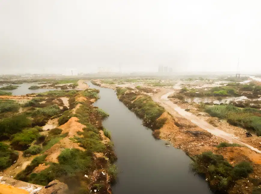
From Plastic Waste to Coastal Resilience, Engineering Solutions for a Cleaner Tomorrow.

      • TCI partnered with the Ocean Cleanup Group to study the influx of plastic waste into the Arabian Sea from the Lyari and Malir Rivers. Our team helped quantify waste flows, identify optimal interceptor locations, and recommend effective mitigation strategies to reduce marine pollution.
      • At Port Qasim and Karachi Port Trust, TCI carried out detailed studies on the health of fragile mangrove forests within the port landscape. These habitats are vital to protecting coastlines, supporting biodiversity, and balancing development with nature.
05
Water Security & Urban Resilience

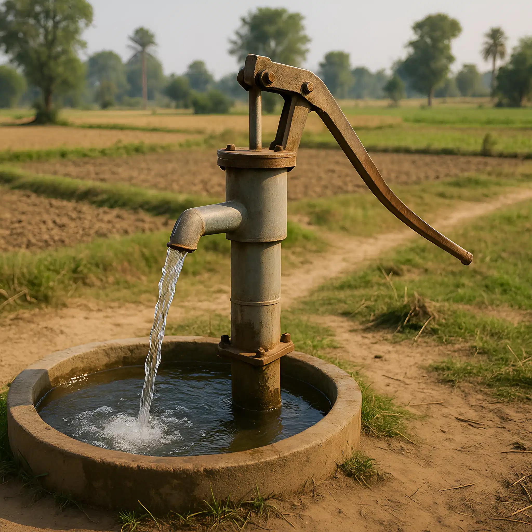
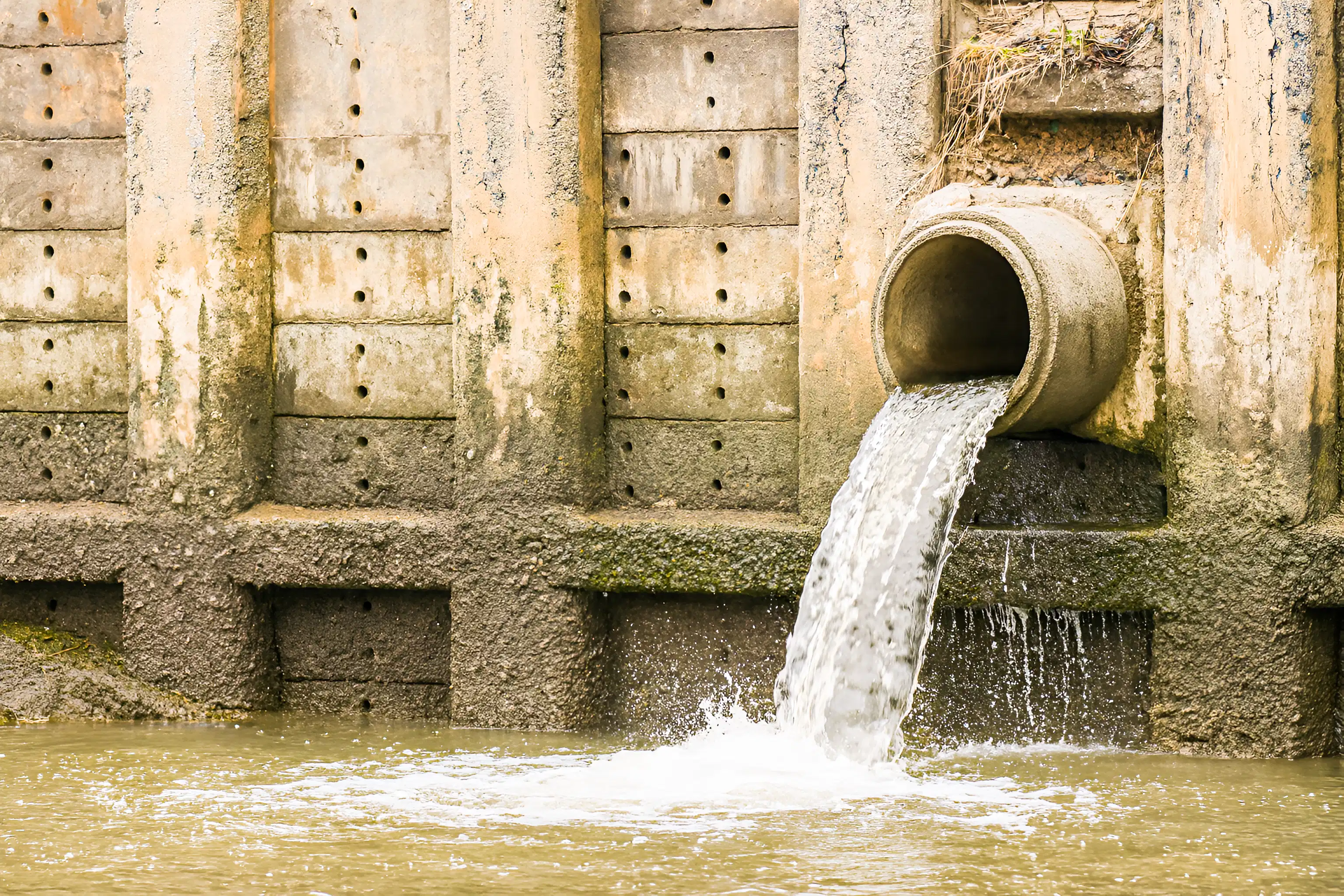
Delivering Safe Water, Sustaining Communities.

  • Ensuring access to clean water is at the heart of sustainable development. In partnership with international donors, we delivered large-scale water supply and sanitation schemes across Jacobabad and multiple cities in Khyber Pakhtunkhwa, Pakistan.
  • The initiative — funded by USAID — included the installation of over 200 km of pipelines and 100+ tube wells, supplying 14.5 million gallons of safe water per day to communities in need. These projects are strengthening urban resilience, improving public health, and securing water resources for generations to come.
06
Transient Analysis & Pipeline Hydraulics

Anticipating Risks. Optimizing Performance.

      • Using industry-leading hydraulic simulation software, we analyze steady and unsteady flows, surge events, and water hammer effects to design systems that are safe, efficient, and resilient.
      • Transient hydraulic analysis for surge, water hammer, and pressure waves
      • Optimization of pumping station operations under varying demand
      • Numerical modelling of pipelines, conveyance systems, and storage reservoirs
      • Design validation to prevent failures and improve system resilience
07
Flood Risk & River Management

Predict. Protect. Prevent.

      • Understanding how water moves through rivers and floodplains is key to protecting people and assets. Through hydrologic analysis, flood risk mapping, and river training solutions, we provide actionable strategies that strengthen resilience against extreme weather events.
          • Hydrologic Modelling: Rainfall-runoff simulations and watershed behaviour analysis
          • Flood Risk Assessment: Mapping floodplains, identifying vulnerable zones, and evaluating scenarios
          • River Training Works: Design of embankments, levees, spurs, and scour protection measures
          • Data-Driven Solutions: Integration of satellite data, GIS, and historical flood records
          • Resilience Planning: Long-term strategies for climate adaptation and disaster risk reduction
08
Dam & Spillway Design

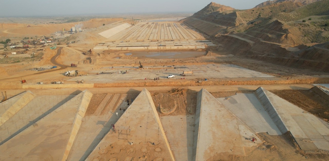
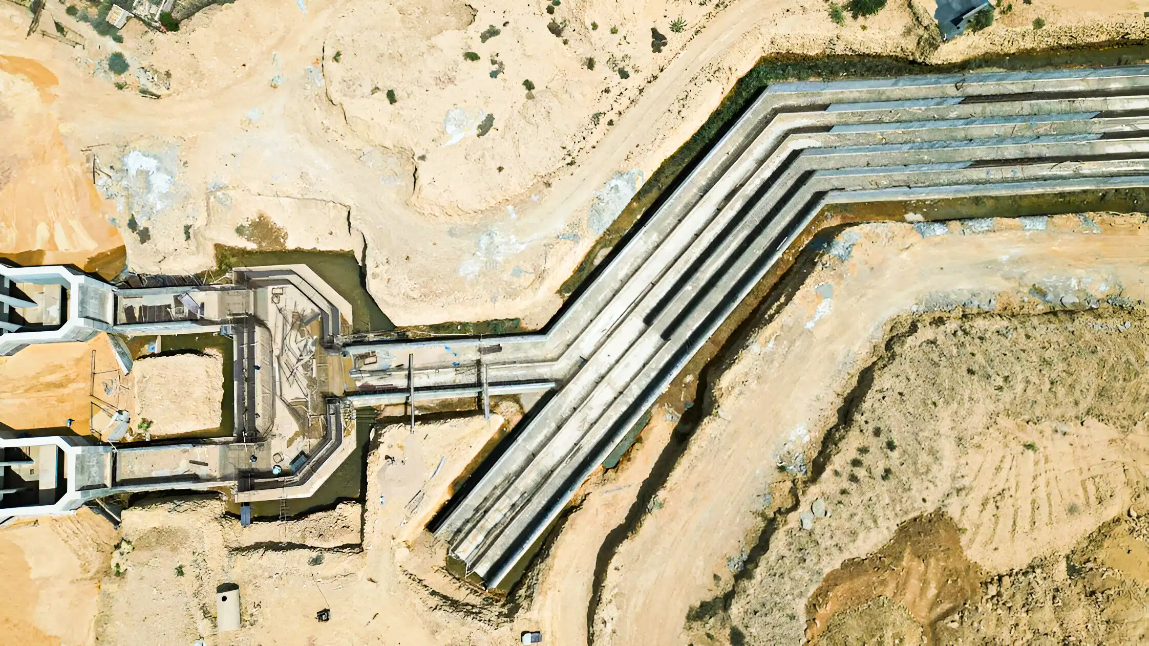
Harnessing Water. Building Resilience.

      • Dams and spillways are at the core of water storage, power generation, and flood protection. Their success depends not only on sound engineering, but also on safety and adaptability to future challenges. Our teams provide integrated design solutions that combine structural strength with hydraulic efficiency.
          • Dam Engineering: Site investigations, geotechnical analysis, and structural design for long-term stability
          • Spillway Solutions: Flood routing capacity studies, energy dissipation structures, and safe discharge systems
          • Hydropower Integration: Assessing turbine layouts, power generation potential, and efficiency improvements
09
Aerial Drone Terrain Mapping

Eyes from Above. Insight on the Ground.

      • Aerial drone mapping provides fast, accurate topographic data — delivering detailed 2D maps and 3D models far more efficiently than conventional surveys. Using photogrammetry, LiDAR scanning, and point cloud processing, we generate precise datasets that form critical inputs for master planning, design studies, and construction quantity take-offs.
          • High-Resolution Terrain Models: Detailed mapping for engineering and planning
          • Point Cloud & 3D Surfaces: Essential for design validation and earthwork calculations
          • Rapid Data Capture: Covering large or difficult-to-access areas efficiently
          • Direct Inputs for Projects: Supporting master plans, feasibility studies, and accurate BOQs
10
Bathymetric Surveys
Bathymetric Surveys

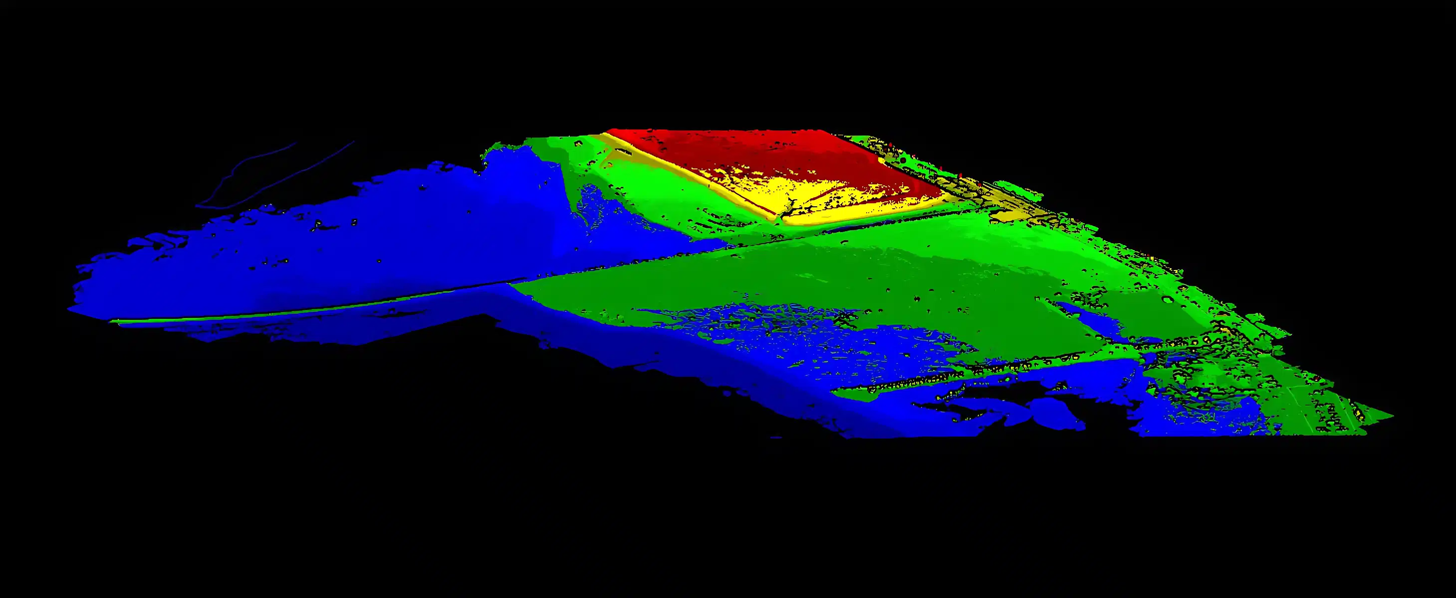
Mapping Depths to Make the Unknown, Known.

      • Understanding the seabed is critical for safe navigation, port operations, and coastal development. With high-resolution multibeam sonar surveys, we map underwater topography to centimeter-level precision, leveraging industry-leading techniques and our own dedicated fleet of survey vessels.
          • Extensive Experience: Over 1,500 km² of seabed mapped across regional waters
          • High-Resolution Data: Multibeam echo sounders capturing the seabed with unmatched accuracy
          • Dedicated Assets: In-house survey vessels and specialized hydrographic equipment
          • Safe Navigation: Surveys support vessel access, turning basins, and harbor approaches
          • Dredging Support: Accurate calculation of capital and maintenance dredging volumes
          • Charting & Planning: Bathymetric data used for navigational chart production and port development
11
Specialized Marine Investigations

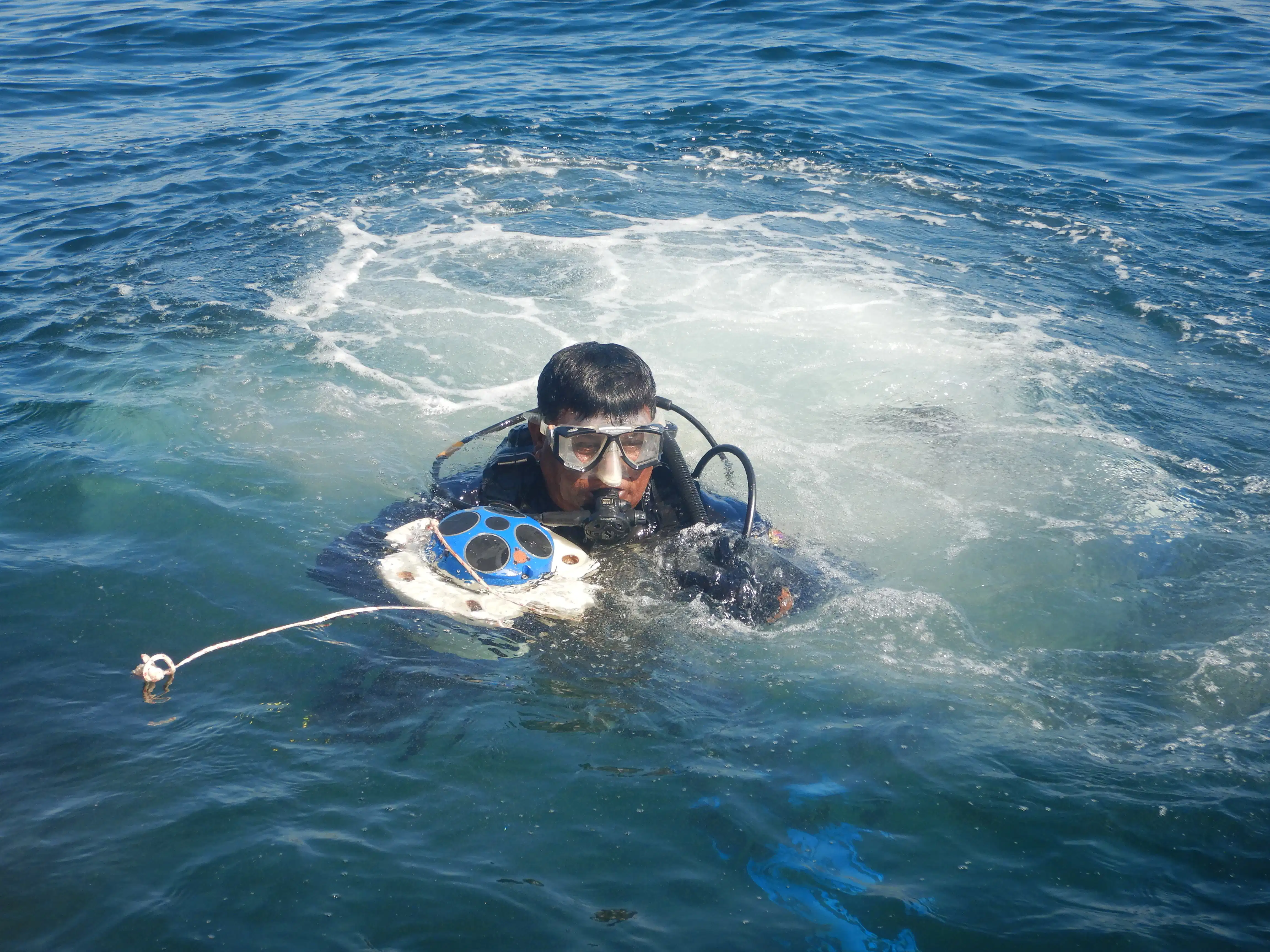
Technology That Sees Beneath the Surface.

      • Marine environments demand precision and specialized expertise. With our in-house dive team and dedicated marine field operators, we deploy advanced technologies to deliver high-quality data for safe, resilient, and cost-effective marine infrastructure design.
          • Wave & Current Monitoring: Deployment of seabed recorders to capture monsoon-driven forces for resilient coastal and offshore design.
          • Side Scan Sonar Surveys: High-resolution visualization of the seabed to assess sub-sea structure integrity and plan corridors for pipelines and cables.
          • Magnetometer Surveys: Identification of hazardous buried metallic objects, including unexploded ordnance (UXO), essential before dredging activities.
          • Tide Gauge Installations: Long-term tidal monitoring for port operations, navigation, and marine structure design.
          • Sub-Bottom Profiling: Imaging soil strata beneath the seabed to support dredging planning and foundation design of offshore and nearshore structures.
          • Diving Operations: In-house dive teams trained for inspections, equipment deployment, and specialized underwater investigations.
12
Numerical Modelling of Waves & Flow

Simulating the Sea to Shape the Shore.

      • Designing marine infrastructure requires more than engineering intuition — it demands a clear understanding of how waves, currents, and tides behave in dynamic coastal environments. With state-of-the-art numerical modelling tools, we simulate hydrodynamic conditions to guide smarter, safer, and more cost-effective design decisions.
          • Breakwater Optimization: Testing alignments and layouts for maximum protection and efficiency.
          • Channel Deepening Studies: Evaluating flow velocities and sediment transport to ensure safe navigation.
          • Land Reclamation Scenarios: Assessing stability, wave exposure, and shoreline impacts of new developments.
          • Hydrodynamic Simulations: Predicting tidal flows, wave climates, and current regimes under different conditions.
          • Design Validation: Using model outputs to refine port layouts, minimize dredging, and improve long-term resilience.
13
Port and Marine Terminal Design

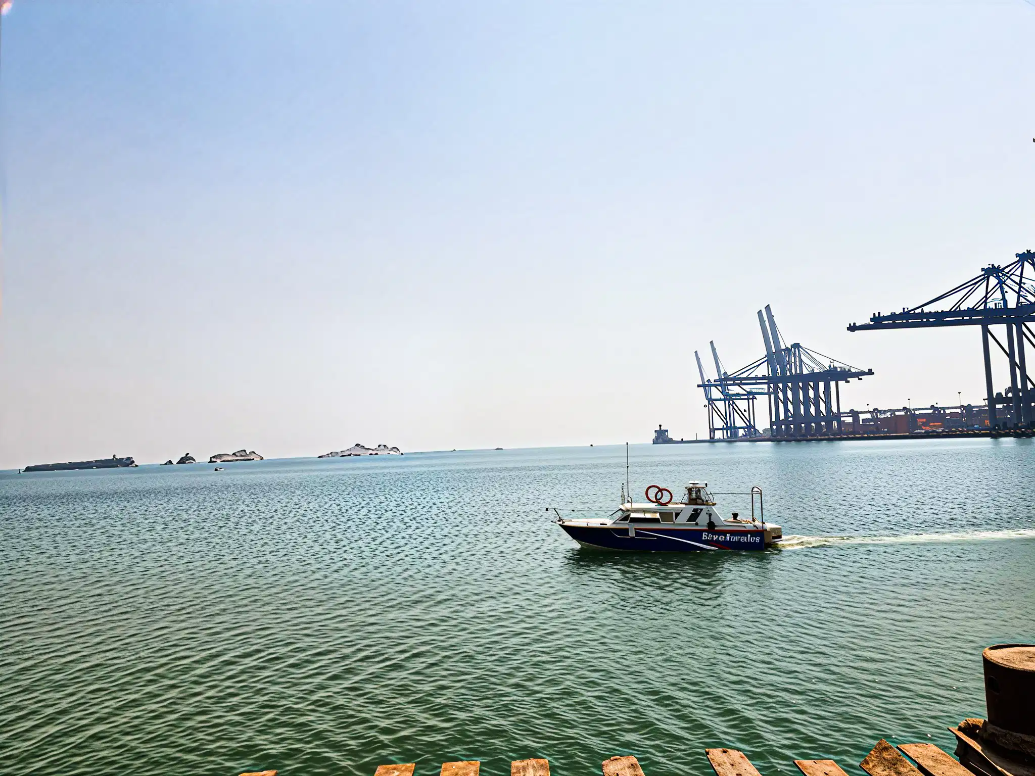
Designing Gateways to Global Trade.

      • Ports and marine terminals are more than just infrastructure — they are lifelines of commerce. We provide integrated planning and design services for ports, harbors, and specialized marine terminals, ensuring efficiency, safety, and long-term resilience against environmental and operational challenges.
          • Master Planning: Layout design for container terminals, bulk facilities, liquid cargo, and multi-purpose ports.
          • Site Selection Studies: Evaluation of coastal locations considering geology, bathymetry, environment, and logistics.
          • Marine Structures: Design of quay walls, jetties, berths, dolphins, and breakwaters.
          • Dredging & Navigation: Channel and basin design, capital and maintenance dredging strategies.
          • Resilience & Adaptation: Incorporating sea-level rise, climate risks, and sustainable development principles.
          • Intermodal Connectivity: Seamless integration of marine terminals with road, rail, and inland logistics networks.
14
Highway Geometrics
Highway Geometrics

Shaping Roads for Safer Journeys.

      • Highways are more than transport corridors — they are lifelines that connect people, cities, and economies. Through advanced geometric design and highway engineering, we ensure road networks are safe, efficient, and built to last. Our expertise covers everything from rural road alignments to complex interchanges and expressways.
          • Geometric Design: Alignments, profiles, and cross-sections optimized for safety and performance
          • Intersection & Interchange Design: Roundabouts, flyovers, signalized intersections, and grade separations
          • Pavement Design & Rehabilitation: Durable pavement structures tailored to traffic loads and climate
          • Drainage & Safety Features: Culverts, stormwater systems, signage, lighting, and guardrails for safer highways
          • Transport Planning Support: Traffic studies, capacity analysis, and integration with regional networks
15
Pavement Design
Pavement Design

Strength Beneath Every Journey

  • A well-designed pavement is the backbone of safe and durable road networks. We apply scientific design methods, material expertise, and field data to deliver pavements that withstand heavy traffic loads and diverse climate conditions — minimizing maintenance costs and maximizing service life.
  • Flexible & Rigid Pavement Design: Solutions tailored to traffic, subgrade conditions, and performance needs
  • Rehabilitation & Overlays: Extending pavement life with cost-effective strengthening strategies
  • Material Selection & Testing: Laboratory and field evaluation of aggregates, asphalt, and concrete mixes
  • Load & Climate Considerations: Designs calibrated for axle loads, temperature variations, and regional conditions
  • Lifecycle Cost Optimization: Balancing initial investment with long-term durability and performance
16
Water & Sewerage Treatment

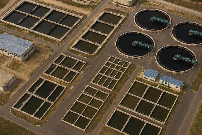
Purifying Today, Preserving Tomorrow

TCI delivers complete water, wastewater, and effluent treatment solutions  from municipal and industrial plants to CETPs, water treatment, and  reverse osmosis (RO) systems. Our designs combine process efficiency,  low operational cost, and environmental compliance, ensuring long-term  sustainability for communities and industries alike.

  • Municipal, industrial & CETP design and supervision
  • Water treatment and RO plant design
  • Treated effluent reuse and recycling systems
  • SCADA-based process monitoring and automation
17
Remote Sensing
Remote Sensing

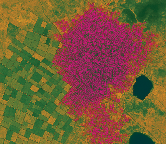
From Pixels to Policy

Satellite imagery offers a clear, data-driven view of how land evolves over time. By classifying and tracking changes across landscapes, we help guide sustainable planning and informed decision-making.

  • Mapping of urban, agricultural, forest, and industrial areas
  • Detecting land use changes and urban expansion
  • Integrating remote sensing data with GIS
  • Supporting zoning and infrastructure master plans
  • Analyzing historical trends to forecast future growth